


By Robert Ashmore
Don’t you just love a Mystery? I do, and here is one of my favorites:
The Incas in South America, primarily in Peru. The Inca empire rose in the highlands of Peru during the 14th century (1438-1553). They built megalithic structures that were almost as mind-blowing as the pyramids in Egypt. The pyramids have been one of the seven wonders of the world since 225 BC. The estimated timeframe for the construction of the pyramids was between 2670 to 2650 BC. The Inca structures were much later, but no less astounding. Let’s start with this fact that the Inca did not have the wheel. OK, that is established, but how on earth did they move the massive stones, some as much as 10 tons? Then, how did they get them into such precise stacking order that they have lasted for hundreds of years and through countless earthquakes? Of course, you know how they did all this from your history classes in high school or college, right? Oh, you were not taught about any of their accomplishments? Well, OK, let’s start with some good old Internet searching so that you can become as mysteriously curious as I am.
The Inca civilization created the largest empire in the Americas. This all took place prior to Christopher Columbus floating over. However, the coming of the Spanish conquistadors in 1532 marked an end to the relatively short-lived Inca Empire. The remains of the Inca civilization are limited, as the conquistadors plundered what they could. Nonetheless, visitors can still gain an appreciation from how advanced the Inca were from the ruins found in the highlands of South America.
Let’s start with the Moray-
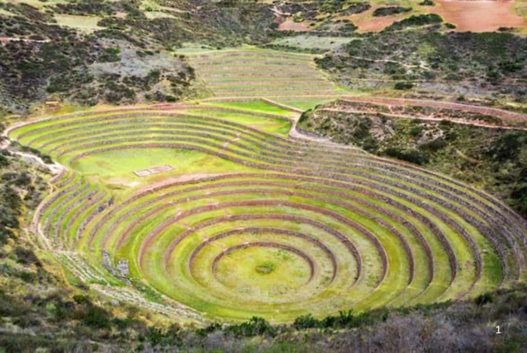
What is a Moray? Investigation has concluded that the Moray is an Incan agricultural ‘experimentation’ area, or some may say an outdoor agricultural ‘laboratory’ that was likely used to cultivate resistant and hearty varieties of plants high in the Andes. The site contains several circular terraces that could be used to study the effects of different climatic conditions on crops. The deepest crater is about 492′ deep with a temperature difference (depending on the season) of up to 50 degrees between the top and the bottom level. Agricultural experimentation started in the mid-19th century for Europeans.
Wiñay Wayna
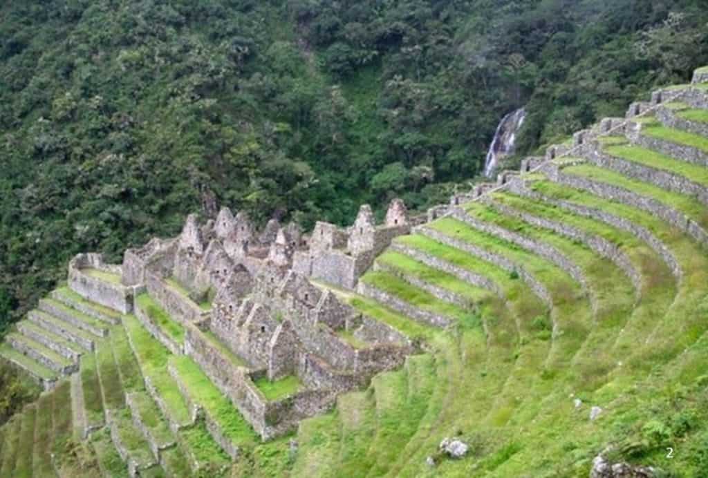
The Inca site of Wiñay Wayna was constructed on a hillside overlooking the Urubamba River. It is located on the Inca Trail and, like today, may have served as a rest stop for weary travelers on their way to famous Machu Picchu. Wiñay Wayna is only about 3 miles from Machu Picchu. The Inca ruins of Wiñay Wayna have upper and lower house complexes connected by a staircase and bath or fountain structures. Beside the houses lies an area of agricultural terraces.
Coricancha
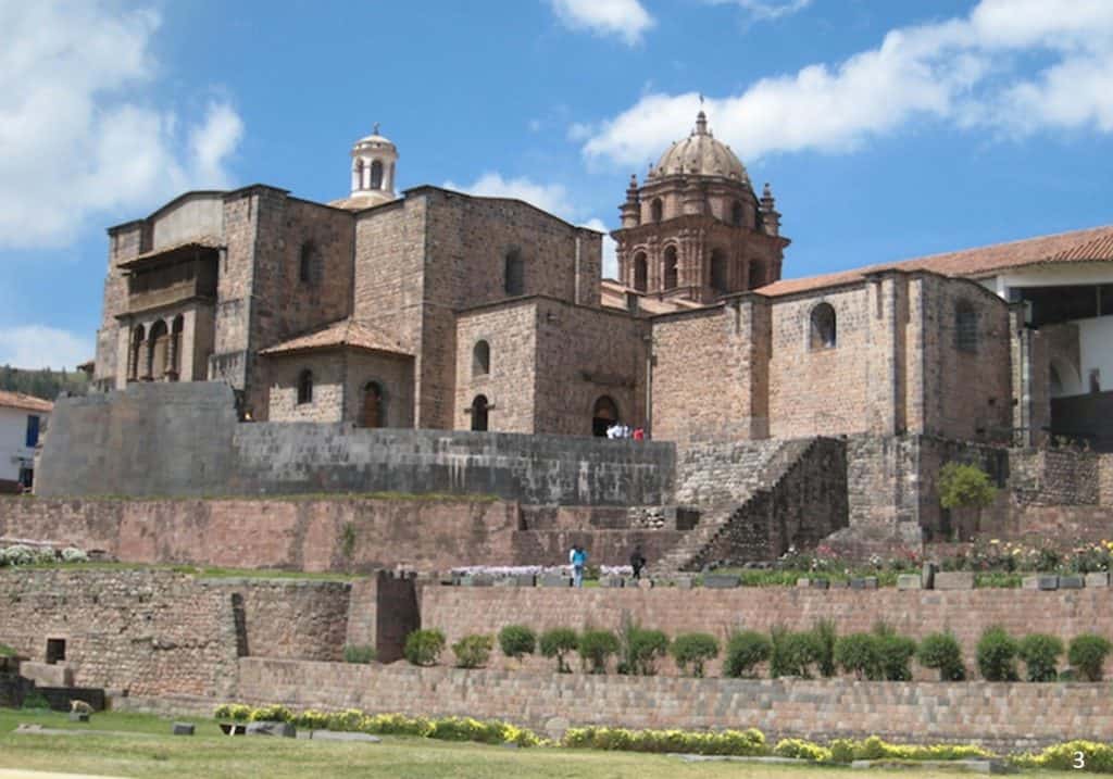
The Coricancha in Cusco, originally named Inti Kancha (‘Temple of the Sun’), was the most important temple in the Incan Empire. The walls and floors were once covered in sheets of solid gold, and the courtyard was filled with golden statues. The conquistadors devastated much of the architectural splendor. Nonetheless, the conquistadors built a Christian church, Santo Domingo, on top of the ruins. Major earthquakes have severely damaged the church, but the Inca stone walls, built out of huge, tightly and mysteriously interlocking blocks of stone, still stand, thanks to the sophisticated stone masonry of the Incas.
Inca Masonry
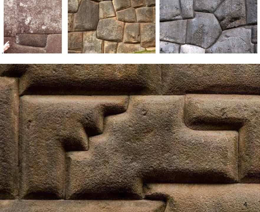
The masonry of the Incas can lead one to believe what some say, “They poured these into molds and then fit them together.” What do you think? Count the sides on these stones and study the accurate cuts and placement. Mysterious indeed…
Llactapata
Located at 9,318′ above sea level along the Inca trail, Llactapata (pronounced Yac-ta-pata) means “High Town.” I don’t think the Inca went here to get high; that is in San Fran… Oh, never mind, I got off track, didn’t I. Llactapata was, according to archeological digs, used for crop production and storage.
Manco Inca (1516-1544) was an Inca prince and later a puppet ruler of the Inca empire under the Spanish rule. Although he initially worked with the Spanish who had put him on the throne of the Inca Empire, he later came to realize that the Spanish would usurp the empire and so fought against them. He spent his last few years in open rebellion against the Spanish. He was eventually treacherously murdered by Spaniards to whom he had given sanctuary. Llactapata was burned by Manco Inca Yupanqui during his retreat to discourage Spanish pursuit. In part due to these efforts, the Spanish never discovered the Inca trail or any of its Inca settlements.
Isla del Sol
Isla del Sol (Island of the Sun) is a rocky, hilly island located in the southern part of Lake Titicaca. According to Inca legend, it was the first land that appeared after the waters of a great flood began to recede and the sun emerged from the island to illuminate the sky once again. The Incas constructed numerous sacred sites on the island. Among these Inca ruins are the Sacred Rock and many labyrinth-shaped buildings called Chicana.
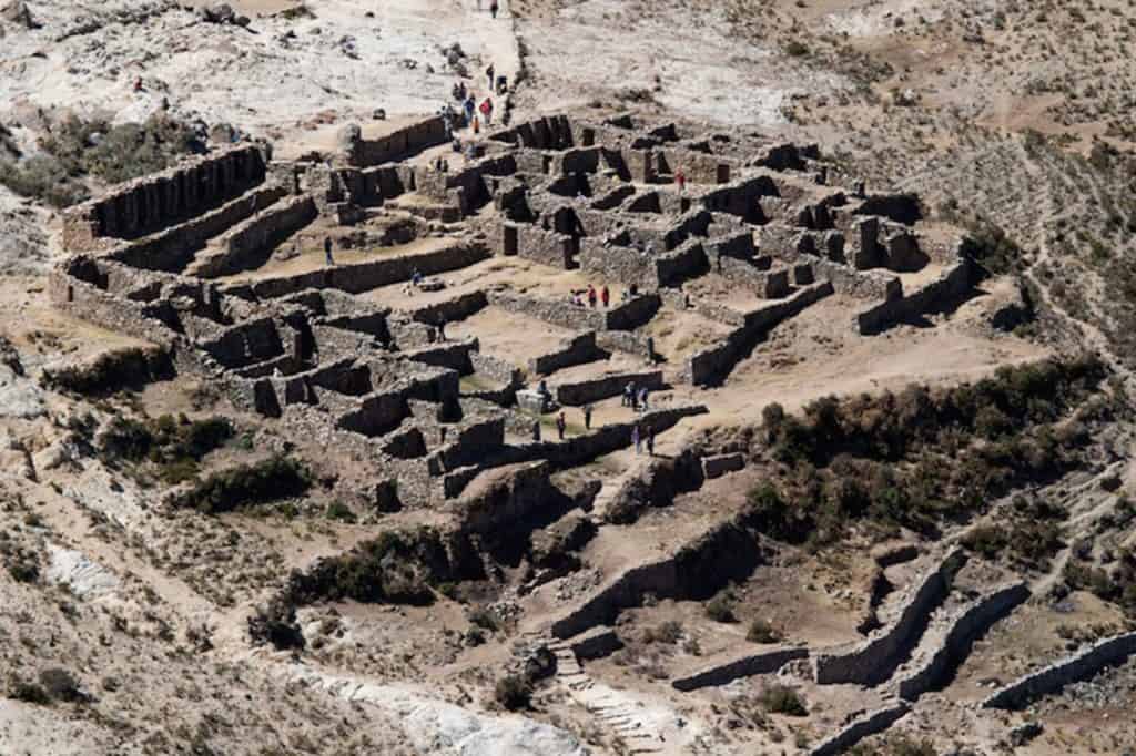
Sacsayhuaman
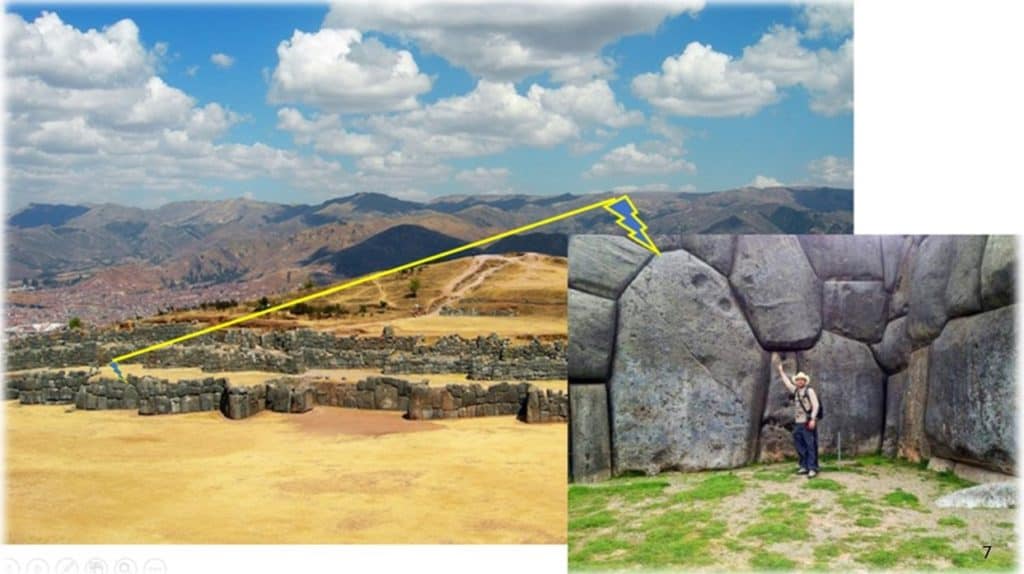
Sacsayhuamán pronounced (sock say hua maun) is an Inca walled complex high above the city of Cusco. The city (Cusco) was laid out in the form of a puma, the animal that symbolized the Inca dynasty. The belly of the puma was the main plaza; the river Tullumayo formed its spine, and the hill of Sacsayhuamán its head. There are three parallel walls built in different levels with limestones of enormous sizes. It is suggested that the zigzagging walls represent the teeth of the puma’s head. The masonry of this Inca-built wall is such that a single piece of paper will not fit between many of the stones. Once again, mystery reigns, with the size and intricate placement of these stones, leaving one to ask the age-old question, “How did the Inca do this?”
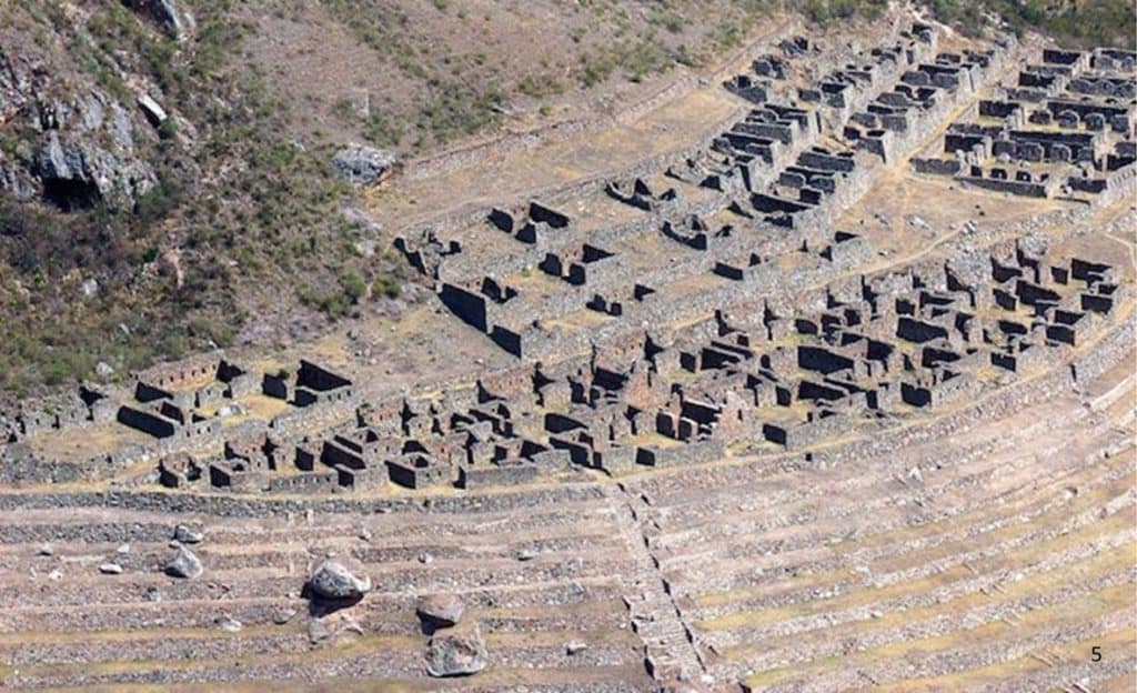
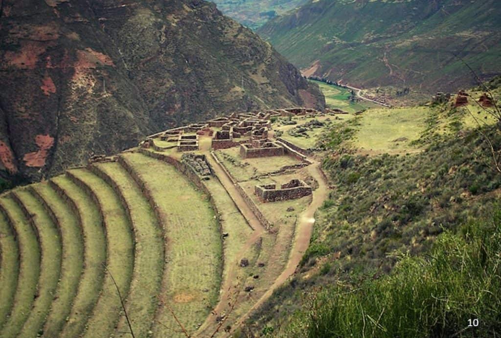
Inca Pisac
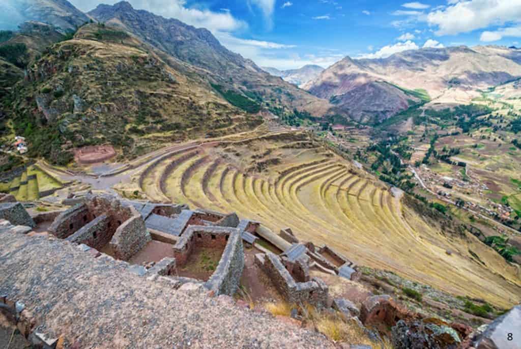
Pisac means “partridge.” Inca traditionally built cities in the shapes of birds and animals. Pisac is partridge-shaped. This Inca ruin included a military citadel, religious temples, and individual dwellings. Overlooking the Sacred Valley between the mountains, it is thought that Písac defended the southern entrance to the Sacred Valley and was a controlling route connecting the Inca Empire with the border of the rain forest.
Choquequirao
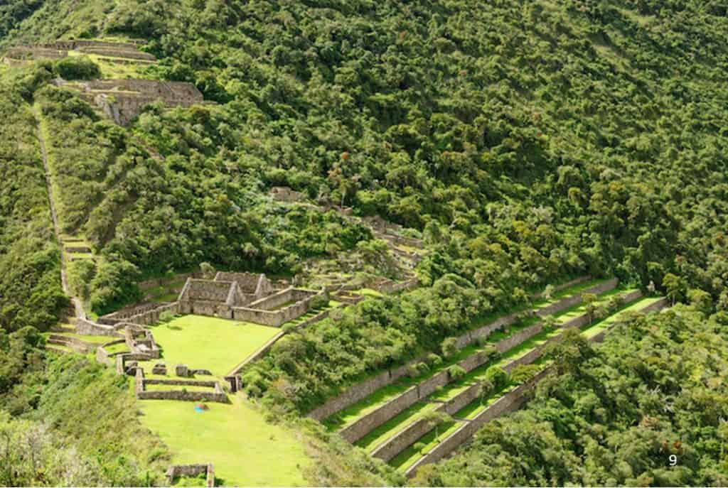
Picture 9Seated on the border of Cuzco and Apurimac, Choquequirao (meaning Cradle of Gold) is located 10,120’ above sea level. There are 180 terraces in this Inca ruin with a staircase configuration. There are no roads to Choquequirao. You can only get there by foot or horseback. The trek to Choquequirao from Cachora can take up to four days!
Ollantaytambo
During the Inca Empire, Ollantaytambo (pronounced O yan tay tam bo) was the royal estate of Emperor Pachacuti who conquered the region. He built the town and a ceremonial center. This became an Inca resistance stronghold during the Spanish conquest of Peru. Now the Inca ruins of Ollantaytambo are an important tourist attraction and one of the most common starting points for a hike on the Inca Trail.
Machu Picchu
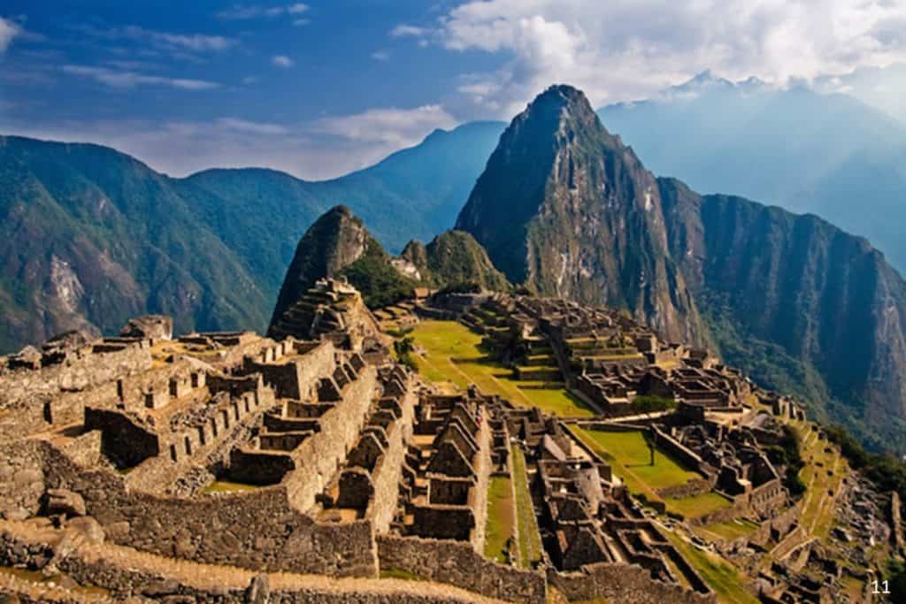
The most beautiful and impressive ancient Inca ruin, Machu Picchu, was rediscovered in 1911 by historian Hiram Bingham after it lay hidden for centuries above the Urubamba Valley. The “Lost City of the Incas” is invisible from below and completely self-contained, surrounded by agricultural terraces and watered by natural springs. Although known locally, it was largely unknown to the outside world before being rediscovered. Since then, Machu Picchu has become the most important tourist attraction in Peru. Mysterious? Well, there are those who say the only tools that the Inca had were made from bronze. They supposedly used rocks and sand in masonry feats that equal or surpass the construction of European structures. Personally, I don’t think so. Nonetheless, I have written a time travel fiction book that gives details of the lives of those who were residing high in the Andes and were used in slave labor on some of the construction.
Cusco/Cuzco is the first of two fiction books, with the second to be published later this year or early next year. I do hope you order it.
Robert Ashmore https://robertashmore7.wixsite.com/mysite

